Become a image contributor at Dreamstime (as your stock photography agent) and start selling your camera and/or cell phone travel and other images. Learn how by clicking on a banner above.
� Robert M. Braley Jr. | Dreamstime.com
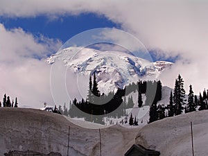
Mount Rainier National Park
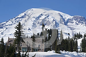
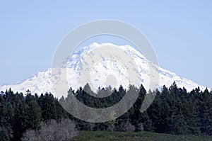
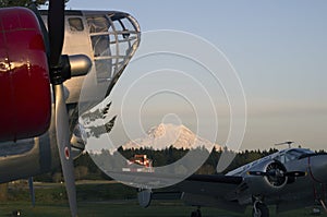
Mount Rainier National Park is a United States National Park located in southeast Pierce County and northeast Lewis County in Washington state. It was established on March 2, 1899 as the fifth national park in the United States. The park encompasses 236,381 acres (369.35 sq mi; 956.60 km2) including all of Mount Rainier, a 14,410-foot (4,390 m) stratovolcano. The mountain rises abruptly from the surrounding land with elevations in the park ranging from 1,600 feet to over 14,000 feet (490 - 4,300 m). The highest point in the Cascade Range, around it are valleys, waterfalls, subalpinemeadows, old-growth forest and more than 25 glaciers. The volcano is often shrouded in clouds that dump enormous amounts of rain and snow on the peak every year and hide it from the crowds that head to the park on weekends.
Washington, USA � Robert M. Braley Jr. | Dreamstime.com
� Robert M. Braley Jr. | Dreamstime.com
� Robert M. Braley Jr. | Dreamstime.com
� Robert M. Braley Jr. | Dreamstime.com
� Robert M. Braley Jr. | Dreamstime.com
� Robert M. Braley Jr. | Dreamstime.com
� Robert M. Braley Jr. | Dreamstime.com
� Robert M. Braley Jr. | Dreamstime.com
� Robert M. Braley Jr. | Dreamstime.com
� Robert M. Braley Jr. | Dreamstime.com
� Robert M. Braley Jr. | Dreamstime.com
� Robert M. Braley Jr. | Dreamstime.com
"Mount Rainier National Park is a United States National Park located in southeast Pierce County and northeast Lewis County in Washington state. It was established on March 2, 1899 as the fifth national park in the United States."
"The park encompasses 236,381 acres (369.35 sq mi; 956.60 km2) including all of Mount Rainier, a 14,411-foot (4,392 m) stratovolcano. The mountain rises abruptly from the surrounding land with elevations in the park ranging from 1,600 feet to over 14,000 feet (490 - 4,300 m). The highest point in the Cascade Range, around it are valleys, waterfalls, subalpinemeadows, old-growth forest and more than 25 glaciers. The volcano is often shrouded in clouds that dump enormous amounts of rain and snow on the peak every year and hide it from the crowds that head to the park on weekends."
"Mount Rainier is circled by the Wonderland Trail and is covered by several glaciers and snowfields totaling some 35 square miles (91 km2). Carbon Glacier is the largest glacier by volume in the contiguous United States, while Emmons Glacier is the largest glacier by area. About 1.8 million people visit Mount Rainier National Park each year. Mount Rainier is a popular peak for mountaineering with some 10,000 attempts per year with approximately 50% making it to the summit." Ref. Wikipedia
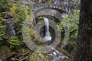
The mesmerizing sight of a never-ending column of water. The beauty and power in the roar of the falls. Because Mount Rainier is the most glaciated peak in the lower 48 states, the park alone is home to over 150 waterfalls, many over 300 feet in height. The 25 active glaciers also power a similar density of waterfalls outside the park boundaries. Many of these waterfalls can be seen from a roadside viewpoint while others are the reward of a day hike. Some are pretty and bubbly, others thunder with power.