Robert M. Braley Jr. Photography

© Robert M. Braley Jr., Photographer


Home

links

Biography

Family Genealogy

Braley Genealogy

Eures Genealogy

Minimalism

United States

USAstatestable

Alaska

Alaska Highway

Milepost

Klondike Gold Rush

NWSR History

NWSR Aircraft

NWSR Other Uses

NWSR Airfields

Highway Proposals 1920s

Canol Pipeline 1942

Hwy Const Start 1942

Hwy Post War Trans 1946

Alaska Hwy Route Markings

Hwy Route Description

Hwy Bypassed Rd Segments

Alaska Hwy Today

Alaska Highway BC

Dawson Creek AH0000

Kaskatinaw River AH0021

Taylor AH0035

Fort St John AH0047

Charlie Lake AH0052

Beatton River AH0073

WonOWon AH0101

Pink Mountain AH0143

Suicide Hill AH0148

Buckinghorse River AH0175

Trutch Mt Summit AH0191

Adsett Creek AH0234

Fort Nelson AH0300

Tetsa River AH0375

Summit Lake 0392

Toad River AH0422

Muncho Lake AH0456

Liard Hot Springs AH0496

Smith River AH0514

Contact Creek AH0588

Teslin AH0604

BC Border AH 0627

Alaska Highway YT

Yukon Border AH0627

Watson Lake AH0635

Cassiar Hwy AW0649

Nugget City AH0650

Rancheria River AH0710

Cont Divide Lodge AH0721

Swift River AH0733

Johnsons Crossing AH0836

Marsh Lake AH0890

Whitehorse AH0905

Whitehorse AH0915

Canyon Creek AH0941

Pine Lake AH1010

Hanes Junction AH1016

Kllane Lake AH1067

Destruction Bay AH1083

Snag Junction AH1188

Burwash Landing AH1093

Beaver Creek AH1202

Alaska Highway AK

US Border AH1221

Border City AH1225

Tetlin AH1229

Deadman Lake AH1249

Deadman Lake CG AH1254

Lake View CG AH1257

Northway JCT AH1264

Taylor Hwy AH1306

Tok River AH1309

Tok Cutoff AH1314

Moon Lake AH1332

Delta Junction AH1422

Arkansas

Alma AR

Fort Smith AR

Van Buren AR

Charleston AR

Mulberry AR

Ozark AR

Altus AR

Clarksville AR

Russellville AR

Akins AR

Plumerville AR

Morriillton AR

Conway AR

Little Rock AR

Little Rock AFB AR

California

Bakersfield

Beverly Hills

Eureka CA

Fall River Mills

George AFB

Klamath AFS

Klamath WWII Radar

Los Angeles

Los Angeles West

Malibu

Samohi

Nautilus 1968

Nautilus 1967

Oxnard

Redwood NP

San Francisco

Santa Monica

Nautilus 1969

Venice

Whiskeytown

Colorado

Connecticut

Delaware

Florida

Georgia

Locust Grove GO

Warner Robbins AFB

Hawaii

Pearl Harbor

Kansas

Cherryvale KS

Coffeyville KS

Garnett KS

Ottawa KS

Kentucky

Idaho

Bosie

Idaho City

Mountain Home

Parma

Illinois

Indiana

Louisiana

Iowa

Maine

Maryland

Massachusetts

Michigan

Minnesota

Mississippi

Missouri

Montana

Nebraska

Gothenburg Neb

Nevada

New Hampshire

New Jersey

New York

New Mexico

Fort Stanton NM

Lincoln NM

Ruidoso

North Carolina

North Dakota

Ohio

Oklahoma

Adair OK

Arkansas River OK

Catoosa OK

Chouteau OK

Gore OK

Martin OK

Muskogee OK

Sallisaw OK

Tulsa OK

Wagoner OK

Warner OK

Webber Falls OK

Oregon

Ashland

Oregon Coast

Pennsylvania

Rhode Island

South Carolina

South Dakota

Tennessee

Athens TN

Knoxville TN

Texas

Utah

Vermont

Virginia

Washington

Anacortes WA

Centralia WA

Chehalis WA

Elbe WA

Fife WA

JBLM

Lewis County WA

Mt Rainer

Olympia WA

Port Angeles

Port Townsend

Seattle

Steilacoom WA

Tacoma

Tacoma TSA

Point Defiance Park

Washington D.C.

Wisconsin

West Virginia

Wyoming

Cheyenne WY

Creston WY

Evanston WY

Fort Bridger WY

Green River WY

Laramie WY

Medicine Bow WY

Pine Bluffs WY

Rock River WY

Table Rock, Wyoming

Walcott WY

Canada

British Columbia

70 Mile House BC

100 Mile House

108 Mile House

Hope BC

Stewart BC

Stewart Cassiar Hwy

Chetwynd

Clinton BC

Fraser River Valley

Hudsons Hope

Huston BC

Pouce Coupe BC

Dawson Creek VC

Dawson Creek DT

Yukon

Crete

Equator

Israel

Products

Nature

Animals

Flowers

Landscapes

Sunset

Wildflowers

Wildlife

Fish

Birds

Albatrosses

Canada Goose

Comorants

CaracarasFalcons

DucksGeeseSwans

Frigatebirds

Grebes

Loons

Osprey

PartridgesGrouse

Pelicans

redwingedblackbird1

HawksKitesEagles

ShearwatersPetrels

StormPetrels

Bats

Vultures

Mammals

Black Bear

bison

BitternsHeronsEgr

Caribou

Carnivorans

Cetaceans

Dall Sheep

Deer

Moose

Mountain Goat

Seals Sea Lions Walrus

Orca

Pikas Hares Rabbits

Polar Bear

Primates

Raccoons

Rodents

Great blue heron

Shrews

Bears

Beaver

Ungulates

Weasels

Military

Alaska Air National Guard

Kulis Air National Guard

Soldiers of the Mists pdf

Soldiers of the Mists

C-17

T-6G

T-33

P-51 Mustang

KC-135

HH-60

F-86

F-80

C-47

HC-130N

C-130H

C-130E

C-123J

Alaska National Guard

Camp Murray

Alaskanized

Ladd AFB

AKNG Museum

U-Tapao

The Salvation Army

Pixels

About

Policy/Copyright

Contact

Robert M Braley Jr

Family

Finance

Photo Sizes

Flag of New Mexico
Seal of New Mexico

New Mexico


Fort Stanton, New Mexico


Lincoln, New Mexico


Ruidoso, New Mexico


New Mexico (Spanish: Nuevo México [ˈnweβo ˈmexiko] (About this soundlisten); Navajo: Yootó Hahoodzo [joː˩tʰo˥ ha˩hoː˩tso˩]) is a state in the Southwestern United States. It is one of the Mountain States of the southern Rocky Mountains, sharing the Four Corners region of the western U.S. with Utah, Colorado, and Arizona, and bordering Texas to the east and southeast, Oklahoma to the northeast, and the Mexican states of Chihuahua and Sonora to the south. The state capital is Santa Fe, which is the oldest capital in the U.S., founded in 1610 as the government seat of Nuevo México in New Spain; the largest city is Albuquerque.

New Mexico is the fifth-largest of the fifty states, but with just over 2.1 million residents, ranks 36th in population and 46th in population density.[Note 1] Its climate and geography are highly varied, ranging from forested mountains to sparse deserts; the northern and eastern regions exhibit a colder alpine climate, while the west and south are warmer and more arid; the Rio Grande and its fertile valley runs from north-to-south, creating a riperian climate through the center of the state that supports a bosque habitat and distinct Albuquerque Basin climate. One–third of New Mexico's land is federally owned, and the state hosts many protected wilderness areas and national monuments, including three UNESCO World Heritage Sites.

New Mexico's economy is highly diversified, with major sectors including oil drilling, mineral extraction, dryland farming, cattle ranching, acequia and landrace agriculture, lumber, retail, scientific research laboratories, technological development, and the arts, especially textiles and visual arts. Its total gross domestic product (GDP) in 2020 was $95.73 billion, with a GDP per capita of roughly $46,300.[8][9] State tax policy is characterized by low to moderate taxation of resident personal income by national standards, with tax credits, exemptions, and special considerations for military personnel and favorable industries; subsequently, its film industry is one of the largest and fastest growing in the country.[10] Due to its large area and economic climate, New Mexico has a significant U.S. military presence, most notably the White Sands Missile Range, and many U.S. national security agencies base their research and testing arms in the state, such as the Sandia and Los Alamos National Laboratories; during the 1940s, Project Y of the Manhattan Project was responsible for the world's first atomic bomb and first nuclear test, Trinity.

In prehistoric times, New Mexico was home to Ancestral Puebloans, Mogollon, and the modern Comanche and Utes.[11] Spanish explorers and settlers arrived in the 16th century, naming the territory Nuevo México after the Aztec Valley of Mexico, more than 250 years before the establishment and naming of the present-day country of Mexico; thus, the state did not derive its name from Mexico.[12][13] Isolated by its rugged terrain and the relative dominance of its indigenous people, New Mexico was a peripheral part of the viceroyalty of New Spain. Following Mexican independence in 1821, it became an autonomous region of Mexico, though this autonomy was increasingly threatened by the centralizing policies of the Mexican government, culminating in the Revolt of 1837; at the same time, the region became more economically dependent on the United States. At the conclusion of the Mexican–American War in 1848, the U.S. annexed New Mexico as part of the larger New Mexico Territory. It played a central role in American westward expansion, and was admitted to the Union in 1912.

New Mexico's history has contributed to its unique demographic and cultural character. One of only six majority-minority states, it has the nation's highest percentage of Hispanic and Latino Americans and the second-highest percentage of Native Americans after Alaska.[14] New Mexico is home to part of the Navajo Nation, 19 federally recognized Pueblo communities, and three different federally recognized Apache tribes. Its large Hispanic population includes Hispanos, who descend from early Spanish settlers, as well as Chicanos and Mexicans. The New Mexican flag, which is among the most recognizable in the U.S.,[15] reflects the state's eclectic origins, bearing the scarlet and gold coloration of Spain's Cross of Burgundy along with the ancient sun symbol of the Zia, a Puebloan tribe.[16] The confluence of indigenous, Spanish, Mexican, Hispanic, and American influences is also evident in New Mexico's unique cuisine, music genre, and architecture.


d2020040100003
 
d2020040100002
d2020040100001

Etymology


New Mexico received its name long before the present-day nation of Mexico won independence from Spain and adopted that name in 1821. The name "Mexico" derives from Nahuatl and originally referred to the heartland of the Mexica (Aztec) Empire in the Valley of Mexico, far from the area of New Mexico.

Following their conquest of the Aztecs in the early 16th century, the Spanish began exploring what is now the western United States, using "Mexico" in 1563 to name the region of New Mexico (Spanish: Nuevo México). In 1581, the Chamuscado and Rodríguez Expedition named the region north of the Rio Grande San Felipe del Nuevo México.[17] The Spaniards had hoped to find wealthy indigenous cultures similar to those of the Mexica's in central Mexico. The indigenous cultures of New Mexico, however, proved to be unrelated to the Mexicas and lacking in riches, but the name persisted.[18][19]

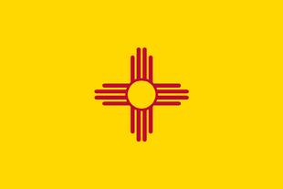
Before statehood in 1912, the name "New Mexico" loosely applied to various configurations of territories in the same general area, which evolved throughout the Spanish, Mexican, and American periods, but typically encompassed most of present-day New Mexico along with sections of neighboring states


History


Prehistory


The first known inhabitants of New Mexico were members of the Clovis culture of Paleo-Indians.[52]:19 Later inhabitants include American Indians of the Mogollon and Ancestral Pueblo peoples cultures.

Seven Cities of Cibola and Nuevo México


Francisco Vásquez de Coronado assembled an enormous expedition at Compostela in 1540–1542 to explore and find the mythical Seven Golden Cities of Cibola as described by Fray Marcos de Niza.[53]:19–24 The name New Mexico was first used by a seeker of gold mines named Francisco de Ibarra, who explored far to the north of New Spain in 1563 and reported his findings as being in "a New Mexico".[54] Juan de Oñate officially established the name when he was appointed the first governor of the new Province of New Mexico in 1598.[53]:36–37 The same year, he founded the San Juan de los Caballeros capital at San Gabriel de Yungue-Ouinge, the first permanent European settlement in New Mexico,[55] on the Rio Grande near Ohkay Owingeh Pueblo.[53]:37 Oñate extended El Camino Real de Tierra Adentro, Royal Road of the Interior, by 700 miles (1,100 km) from Santa Bárbara, Chihuahua, to his remote colony.[56]:49

The settlement of La Villa Real de la Santa Fe de San Francisco de Asís was established as a more permanent capital at the foot of the Sangre de Cristo Mountains in 1610.[56]:182 As a result of the Pueblo Revolt, the only successful revolt against European expansion by Native Americans, these early cities were occupied by the Puebloan peoples until the Spanish returned with an offer of better cultural and religious liberties for the Pueblos.[57][58][52]:6, 48 After the death of the Pueblo leader Popé, Diego de Vargas restored the area to Spanish rule.[53]:68–75 The returning settlers founded La Villa de Alburquerque in 1706 at Old Town Albuquerque as a trading center for existing surrounding communities such as Barelas, Isleta, Los Ranchos, and Sandia,[53]:84 naming it for the viceroy of New Spain, Francisco Fernández de la Cueva, 10th Duke of Alburquerque.

As a part of New Spain, the claims for the province of New Mexico passed to independent Mexico in 1821 following the Mexican War of Independence.[53]:109 The Republic of Texas claimed the portion east of the Rio Grande when it seceded from Mexico in 1836 when it incorrectly assumed the older Hispanic settlements of the upper Rio Grande were the same as the newly established Mexican settlements of Texas. Texas's only attempt to establish a presence or control in the claimed territory was the failed Texan Santa Fe Expedition. Their entire army was captured and jailed by the Hispanic New Mexico militia.

At the turn of the 19th century, the extreme northeastern part of New Mexico, north of the Canadian River and east of the Sangre de Cristo Mountains was still claimed by France, which sold it in 1803 as part of the Louisiana Purchase. When the Louisiana Territory was admitted as a state in 1812, the U.S. reclassified it as part of the Missouri Territory. The region (along with territory that makes up present-day southeastern Colorado, the Texas and Oklahoma Panhandles, and southwestern Kansas) was ceded to Spain under the Adams-Onis Treaty in 1819.

By 1800, the population of New Mexico had reached 25,000.


Territorial phase


Following the victory of the United States in the Mexican–American War (1846–48), the Treaty of Guadalupe Hidalgo resulted in Mexico ceding its northern holdings to the U.S., including the territories of California, Texas, and New Mexico.[53]:132 The American government vowed to accept the residents' claims to their lands and to accept them as full citizens with rights of suffrage.

After Texas was admitted as a state in 1845, it continued to claim a northeastern portion of New Mexico east of the Rio Grande. Under the Compromise of 1850, it was forced by the U.S. government to drop these claims in exchange for $10 million in federal funds.[53]:135 Pursuant to the compromise, Congress established the separate New Mexico Territory in September. of that year;[61] it included most of present-day Arizona and New Mexico, along with the Las Vegas Valley and what would later become Clark County in Nevada.

In 1853, the U.S. acquired the mostly desert southwestern bootheel of the state, along with Arizona land south of the Gila River, in the Gadsden Purchase, which was needed for the right-of-way to encourage construction of a transcontinental railroad.[53]:136

Civil war effects in New Mexico

When the U.S. Civil War broke out in 1861, both Confederate and Union governments claimed ownership and territorial rights over New Mexico Territory. The Confederacy claimed the southern tract as its own Arizona Territory, and as part of the Trans-Mississippi Theater of the war, waged the ambitious New Mexico Campaign to control the American Southwest and open up access to Union California. Confederate power in the New Mexico Territory was effectively broken after the Battle of Glorieta Pass in 1862. However, the Confederate territorial government continued to operate out of Texas, and Confederate troops marched under the Arizona flag until the end of the war. More than 8,000 men from New Mexico Territory served in the Union Army.[62]

During the American frontier, many of the folklore characters of the Western genre had their origins in New Mexico, most notably businesswoman Maria Gertrudis Barceló, outlaw Billy the Kid, as well as lawmen Pat Garrett and Elfego Baca.

In the late 19th century, the majority of officially European-descended residents in New Mexico were ethnic mestizos of Native Mexican and Native American (Pueblo, Navajo, Apache, Genízaro, and Comanche) ancestry, many of whom had deep roots in the area from early Spanish colonial times, this distinctly New Mexican ethnic group became referred to as the Hispanos of New Mexico. Politically, they still controlled most of the town and county offices through area elections, and wealthy sheepherder families commanded considerable influence, preferring business, legislative, and judicial relations with fellow indigenous New Mexican groups. The Anglo Americans (which included recent African American arrivals) tended to have more ties to the territorial governor and judges, who were appointed by officials outside of the region. The Anglo minority was "outnumbered, but well-organized and growing".[63] These newly arrived settlers often tried to maintain New Mexico as a territory, since the governor was being assigned by the President of the United States, and they were worried about Native and Hispano communities being in positions of power. This mob mentality would sometimes culminate in the lynching of the Native, Hispanic, and Mexican peoples, as was attempted at the Frisco shootout. Prominent people attempted to fight this prejudice, including Vigil, Garrett, Otero, Curry, Larrazolo, Baca, Hagerman, and major constituents from both major political parties, the Democratic Party of New Mexico and the Republican Party of New Mexico.


Statehood


The United States Congress admitted New Mexico as the 47th state on January 6, 1912.[53]:166 It had been eligible for statehood 60 years earlier but was delayed due to its majority of the population being "alien" (i.e. Mexican-American).[66]

European-American settlers in the state had an uneasy relationship with the large Native American tribes, most of whose members lived on reservations at the beginning of the 20th century. Although Congress passed a law in 1924 that granted all Native Americans U.S. citizenship, as well as the right to vote in federal and state elections, New Mexico was among several states with Jim Crow laws, e.g. those who do not pay taxes cannot vote.[67]

A major oil discovery in 1928 brought wealth to the state, especially Lea County and the town of Hobbs. The town was named after James Hobbs, a homesteader there in 1907.[68] The Midwest State No. 1 well, begun in late 1927 with a standard cable-tool drilling rig, revealed the first signs of oil from the Hobbs field on June 13, 1928. Drilled to 4,330 feet and completed a few months later, the well-produced 700 barrels of oil per day on state land. The Midwest Refining Company's Hobbs well-produced oil until 2002. The New Mexico Bureau of Mines and Mineral Resources called it "the most important single discovery of oil in New Mexico's history".[69]

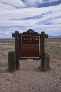
During World War II, the first atomic bombs were designed and manufactured at Los Alamos, a site developed by the federal government specifically to support a high-intensity scientific effort to rapidly complete research and testing of this weapon. The first bomb was tested at Trinity site in the desert between Socorro and Alamogordo on what is now White Sands Missile Range.[53]:179–180


Any other citizen, regardless of race, in the State of New Mexico who has not paid one cent of tax of any kind or character, if he possesses the other qualifications, may vote. An Indian, and only an Indian, in order to meet the qualifications to vote, must have paid a tax. How you can escape the conclusion that makes a requirement with respect to an Indian as a qualification to exercise the elective franchise and does not make that requirement with respect to the member of any race is beyond me.[67]Native Americans from New Mexico fought for the United States in both the First and Second World Wars. Veterans were disappointed to return and find their civil rights limited by state discrimination. In Arizona and New Mexico, veterans challenged state laws or practices prohibiting them from voting. In 1948, after veteran Miguel Trujillo, Sr. of Isleta Pueblo was told by the county registrar that he could not register to vote, he filed suit against the county in federal district court. A three-judge panel overturned as unconstitutional New Mexico's provisions that Indians who did not pay taxes (and could not document if they had paid taxes) could not vote.[67] Judge Phillips wrote:

New Mexico has received large amounts of federal government spending on major military and research institutions in the state. It is home to three Air Force bases, the White Sands Missile Range, and the federal research laboratories Los Alamos National Laboratory and Sandia National Laboratories. The state's population grew rapidly after World War II, nearly doubling between 1940 and 1960;[71] by 2000, residents numbered over 1.8 million from roughly 532,000 in 1940.[72] While the high military presence brought considerable investment, it has also been the center of controversy; on May 22, 1957, a B-36 accidentally dropped a nuclear bomb 4.5 miles from the control tower while landing at Kirtland Air Force Base in Albuquerque; only its conventional "trigger" detonated.[73][74]

In addition to federal personnel and agencies, many residents and businesses moved to state, particularly from the northeast, often drawn by its warm climate and low taxes. The pattern continues into the 21st century, with New Mexico adding over 400,000 residents between 2000 and 2020.

In the late 20th century, Native Americans were authorized by federal law to establish gaming casinos on their reservations under certain conditions, in states which had authorized such gaming. Such facilities have helped tribes close to population centers generate revenues for reinvestment in the economic development and welfare of their peoples.

In the 21st century, employment growth areas in New Mexico include electronic circuitry, scientific research, call centers, and Indian casinos.


Ref Wikipedia

Website powered by Network Solutions®