Become a image contributor at Dreamstime (as your stock photography agent) and start selling your camera and/or cell phone travel and other images. Learn how by clicking on a banner above.
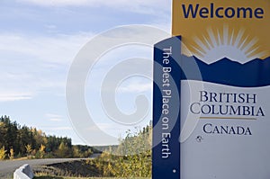
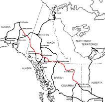
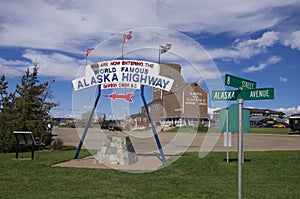
The Alaska Highway Dawson Creek, British Columbia to Delta Junction, Alaska (historical routes, heritage sites, sightseeing, driving tour) Pioneer Road - Contract Road - Public Road
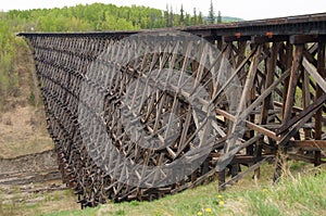
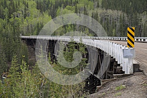
Pouce Coupe, British Columbia, Canada,www.poucecoupe.capopulation 740, is 6 miles (10km) east of Dawson Creek – I spent a day in Pouce Coupe visiting the museum and viewing the vintage railway trestle.
All American men and equipment bound for Dawson Creek to build the ALCAN Highway would have crossed this trestle. The railroad trestle is still standing today, but is no longer in use. Pouce Coupe
The Village of Pouce Coupe (French for "cut thumb") is a small town in northeastern British Columbia, Canada, and a member municipality of the Peace River Regional District. It was originally named 'Pouskapie's Prairie', after the name of the local native band chief. The 2.06-square-kilometre (0.80 sq mi) municipality is home to 739 residents.
The community was settled by European immigrant Hector Tremblay in 1898. Tremblay, a French speaker, rendered 'Pouskapie's Prairie' into the nearest French words of similar sound. Pouce Coupe is approximately 10 km (6.2 mi) southeast of Dawson Creek along Highway 2. It is approximately 35 km (22 mi) northwest of the Alberta border along Highway 2. The village is at an elevation of 655 metres (2,149 ft) in the Peace River Country.
Pouce Coupe's main industries today are petroleum, agriculture, and tourism. Popular recreational activities in the area include cross-country skiing, snowmobiling, fishing, hiking, and hunting. The Village claims to be "the pioneer capital of the Peace Region"
History
While there is debate regarding the origin of the name 'Pouce Coupe', the first known reference to it was in McLeod's Fort Dunvegan Journal, 1986 which identified a Beaver Indian Chief named 'Pooscapee'. The region became known as the Pouce Coupe Prairie, from which the river and village took their names. Permanent settlement began after the French-Canadian voyageurs Hector Tremblay and Joe Bissette left their group of prospectors from Kamloops during the Klondike Gold Rush and became the first settlers in the Pouce Coupe Prairie. In 1898 Bissette built his cabin in the present day Pouce Coupe Regional Park at the confluence of Bissette Creek and Pouce Coupé River, but soon moved on to Dunvegan, Alberta. Tremblay, joined by his wife and children in 1908, built his cabin at the confluence of Dawson Creek and Pouce Coupé River. Tremblay used his cabin as a trading post for local aborinal tribe and resting place for the trickle of travellers that passed through. He also tried ranching cattle and helped cut trails south to Grande Prairie and north to Fort St. John. When the Dominion Government opened the Peace River Block for homesteading, the trails created an influx of settlers between 1912 and 1914. A community began to emerge around Tremblay's cabin as he ran a small store and post office aided inexperienced settlers. This community center moved in 1916 when the post office moved to Frank Haskin's general store and a bank opened nearby.
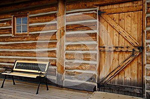
Click on image to purchase
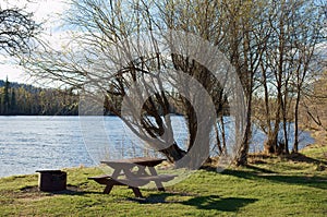
Click on image to purchase
After WWI homestead grants to returning soldiers created another wave of settlers and the community center moved to its present location in the early 1920s when the post office and other businesses moved to a newly subdivided townsite on Charlie LeRoy's homestead. Until 1932 Pouce Coupe would be the service center for the region. The federal government established an office in the emerging village in 1915 and provincial government followed in 1921. The first school opened in 1917, the Alberta Red Cross opened a hospital in 1921, and the Pouce Coupe Light and Power Co. was established in 1931.
As Northern Alberta Railways was extending their rail lines westward, to Wembley, Alberta in 1924 and to Hythe, Alberta in 1928, it was expected that Pouce Coupe would be next in line. However, as land prices rose and speculation increased, the company made a deal to build the next station near the smaller community of Dawson Creek. The first train went through Pouce Coupe and arrived in Dawson Creek in on January 15, 1931. Despite the Great Depression and Dawson Creek's increasing dominance over the region as the westernmost rail connection, Pouce Coupe continued to grow, and incorporated as a village, as westward migration into the Peace River Country continued.
The 1941 census recorded 251 people living in the village. In 1942 the population swelled, as the US Army unloaded thousands of men and construction material in nearby Dawson Creek to build the Alaska Highway. The highway was built and the US Army gone within a year but by 1951 the population that remained numbered 459 residents. The village was connected to drinking water and sewage system in 1950, and a natural gas in 1954. In large part because of the Women's Institute a library opened in 1951 and a new hospital in 1954. In the following decades the village would remain in the shadow of Dawson Creek as the provincial and federal government offices moved there in the 1970s. The population level fluctuated between 800 and 930 people since then with the peak occurring in 1996 at 928 people. In 2007, a large boundary extension northward over agricultural land neary doubled the area of the village and brought its borders within metres of the City of Dawson Creek's.