Become a image contributor at Dreamstime (as your stock photography agent) and start selling your camera and/or cell phone travel and other images. Learn how by clicking on a banner above.
Oregon Coast
2016101000025
2016101000061
2016101000016
2016101000017
2016101000022
2016101000010
2016101000011
2016101000015
2016101000018
2016101000064
2016100900134
2016100900146
2016100900147
2016100900040
2016100900043
2016100900110
2016100900104
2016100900107
2016100900125
2016100900096
2016100900097
2016100900098
2016101000023
2016101000072
2016100900089
2016100900091
2016100900095
2016100900059
2016100900076
2016100900088
2016101000158
2016101000086
2016100900052
2016100900057
2016100900058
2016100900013
2016100900021
2016100900050
2016101000173
2016101000181
2016100900006
2016100900008
2016100900011
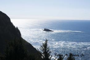
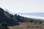
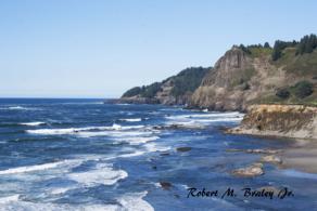
The Oregon Coast is more than a place, it's a state of mind. No place on the map of Oregon is marked as the Oregon Coast, but everybody knows that the 363 miles of coastline where the Pacific Ocean washes up on the state's western beaches is unlike any place else.
Highway 101 winds down the entire Oregon Coast from the Columbia River to the California border. Along the way, it passes through the old growth forests of Oswald West State Park, name for the Oregon governor who began the process of securing Oregon's beaches for public use. All but one of the famous McCullough bridges on Highway 101 are still in operation. The only one that has been replaced is across Alsea Bay at Waldport. Before the bridges were completed during the Great Depression, travel down the Oregon Coast required many ferry trips across the mouths of rivers.
The coast is generally divided into three regions. The North Oregon Coast corresponds to Clatsop and Tillamook counties, and runs from the Columbia River to Cascade Head. Astoria is not just the northernmost city on the Oregon Coast, it is also the oldest American settlement west of the Mississippi. Seaside was an early resort town and is still a popular destination. Cannon Beach is famous for its sandcastle contest and has an active arts community.
Tillamook County is the home of the Tillamook Cheese factory, the top tourist attraction on the coast. The county is divided roughly into three sections. The northern section includes Rockaway Beach, which is where people from Portland vacationed on the Oregon Coast early in the 20th century, arriving by train over the Coast Range. Tillamook itself is the county seat and serves the local dairy and cheesemaking industries. The growing town of Pacific City is famous for its dory boats and the waves at Cape Kiwanda.
Lincoln County considers itself to be the Central Oregon Coast all by itself, although a look at the map would suggest that Florence and Reedsports should be included. Nevertheless, its many miles of sandy beaches attract so many visitors that it may deserve the title. Kite flying is popular at Lincoln City. Newport has an active fishing community on its bayfront and is also the site of the Oregon Coast Aquarium, erstwhile home of Keiko the Orca whale. Yachats is a tiny but popular community just north of Cape Perpetua.
Florence has been growing rapidly for several decades and has been one of the fastest growing cities in Oregon. A large number of people who choose to retire to the Oregon Coast have made Florence their home. It is also the northernmost edge of the Oregon Dunes National Recreation Area, which extends through Reedsport and down to Coos Bay. Reedsport is several miles inland from the mouth of the Umpqua River. Winchester Bay is near the mouth and is popular with tourists. The Umpqua Lighthouse attracts many visitors. A viewpoint along Highway 101 just south of Winchester Bay provides views of the river, the lighthouse, and the ocean beaches.
Coos Bay is the name of both a city and a body of water. It is the largest town on the Southern Oregon Coast and along with its sister city North Bend constitutes the largest metro area on the entire Oregon Coast. Both cities developed due to the timber industry. Tourists are more attracted to Charleston, located where Coos Bay opens onto the Pacific Ocean. The famous gardens of Shore Acres are just south along the Cape Arago Highway.
The state parks along the Oregon Coast were among the first to be developed in the Oregon State Park system. The foresight of the Oregon legislature in securing so many wonderful locations along the coast has guaranteed access to the beach for campers and day users for future generations.
Highway 101 Astoria to Seaside
U.S. Highway 101 from Astoria to the California state line is part of our national scenic heritage. In 2002 it received federal recognition as an All American Road and is known as the Pacific Coast Scenic Byway. Look for blue-and-white signs posted along the highway.
Mile 0 is the south end of the Astoria–Megler Bridge. Over four miles long, this bridge is the longest continuous three-span, through-truss bridge in the world. Construction began in 1962 and was completed in 1966. For many years it was a toll bridge, but the bonds were paid off more than a decade ago. This bridge completed Hwy 101 and made it an unbroken link between the Canadian and Mexican borders. The city of Astoria (ZIP 97103) lies mostly upriver from Mile 0.
M.P. 5.0 Youngs Bay Bridge - Hwy 101 crosses Youngs Bay on a 4200-foot, lift-span bridge. The lift is only used for very large ships. The clearance is 45 feet in the closed position and 80 feet when raised.
7.0 Fort Clatsop - For a glimpse of life during one of the most important expeditions in the nation’s history, travel 3 miles east on Old Hwy 101 to Fort Clatsop Road and follow signs to Fort Clatsop, one of the major sites in the Lewis and Clark National Historic Park. This is where the Lewis and Clark expedition spent the winter of 1805–1806.
7.5 South Access to Fort Stevens
9.9 Camp Rilea Military Reserve - Camp Rilea was founded in 1927 as Camp Clatsop. It was renamed Camp Rilea in 1959 and is a military training camp for police, the National Guard, and others.
10.5 Fort-to-Sea Trail - Newly dedicated in 2005, the Fort-to-Sea Trail crosses under Hwy 101 at this point. The full 6.5-mile length extends from Fort Clatsop to Sunset Beach. Parking here is limited.
U.S. Highway 101 Cannon Beach to Manzanita
This is not the original Highway 101. At first, the highway turned inland north of Cannon Beach and returned to the coast at the head of Nehalem Bay near Wheeler.
Between Cannon Beach and Arch Cape, there are several parks and viewpoints, but the really spectacular part starts with the tunnel just south of Arch Cape. As the highway passes over the lower slopes of Neahkahnie Mountain, several turnouts provide views of the coast both north and south.
The highway returns to near sea level at the turnoff to Manzanita.
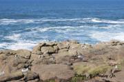
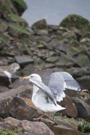
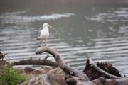
30.5 Cannon Beach South Access Haystack Rock, part of Oregon Islands National Wildlife Refuge and the unofficial symbol of Cannon Beach, lies just south. This 235-foot monolith is home to many species of nesting birds. Between April and August, tufted puffins abound. Do not disturb either the birds or marine life in tide pools. These marine gardens are protected by the state.
30.8 Tolovana Park (ZIP 97145) Tolovana Park is adjacent to Cannon Beach and has resorts, shops, and restaurants. The main street running through Cannon Beach and Tolovana Park is Hemlock Street. Tolovana Beach Wayside, across Hemlock from the access to Hwy 101, is a good place to park and walk to Haystack Rock.
31.6 Viewpoint See the beach from Tillamook Head south toward Cape Falcon.
33.7 Hug Point State Park The old road was treacherous, and travelers had to hug the rock here to get around the point. The road was closed during high tides. Visitors can explore tidal caves, hike to a waterfall, and investigate the remains of the old roadbed.
42.8 Neahkahnie Beach Trails lead to the summit of the mountain from this popular beach at the base of Neahkahnie Mountain. Stories of buried treasure arose more than two centuries ago when, according to legend, a badly crippled, treasure-rich Spanish galleon strayed off course and was wrecked on the beach. Native Indians told of seeing a huge canoe cast on the shore with its great white wings flapping in the wind. They said the men from the ship carried boxes from the wreck and buried them at the foot of the mountain. No one has ever found the treasure, but many artifacts, including a wine cup and beeswax, have been found.
43.0 Manzanita (ZIP 97130)
Highway 101 Manzanita to Tillamook
Highway 101 winds along near water as it passes through northern Tillamook County. From Manzanita, it's a short distance south to Nehalem, where the highway begins to track along the Nehalem River. Past Wheeler, the river empties into the Pacific and Highway 101 then follows along the beach, past Rockaway Beach, until it reaches the edge of Tillamook Bay at Barview. From there, it winds along the edge of Tillamook Bay until past Garibaldi it turns inland, away from the increasingly shallow waters of the bay, until it reaches Tillamook, the county seat of Tillamook County.
54.0 Three Graces Watch for wildlife on these three monumental rocks within the bay.
54.8 Tillamook Bay Viewpoint
63.9 Tillamook Cheese Factory Ample parking is available at the largest cheese factory on the coast. See cheese being produced as you take a self-guided tour. Besides cheese, shop a wide selection of gift items for sale, as well as yummy ice cream. In front of the factory is a replica of the Morning Star, a ship built in 1854 to carry local products to market. Tillamook Chamber & Visitors Center is at the south edge of the parking lot.
64.1 Wilson River Bridge This McCullough designed bridge, built in 1931, is known as a bowstring arch design very similar to Big Creek bridge in Lane County south of Yachats.
Highway 101 Tillamook to Lincoln City
In southern Tillamook County, Highway 101 is not the scenic route. That's the Three Capes Loop, which follows the ocean along the western edge of the county. Highway 101 stays far inland for most of this stretch, although it comes close to the ocean in a couple of places near Neskowin. After climbing over Cascade Head, it returns to sea level at the Salmon River and shortly arrives in Lincoln City.
Three Capes Loop Highway
Highway 101 follows an inland path through southern Tillamook County. Those wanting to see the ocean beaches instead follow the Three Capes Loop. The north end begins in Tillamook. Signs identify the road west. Not far out of town, the road branches. The north branch follows Tillamook Bay out to Cape Arago. The south branch takes a shortcut across the peninsula. The loop turns south at Cape Arago and rejoins this shortcut at Netarts. From there, the highway follows the inside of Netarts Bay, past Cape Lookout, and further south to meet another cross-peninsula shortcut at Sandlake. From Sandlake, it follows the coastline past Cape Kiwanda to Pacific City, after which it rejoins Highway 101 a few miles south.
Cape Lookout State Park is situated near the midpoint of the Three Capes Loop. The park includes both the cape itself, which is a rocky headland jutting into the Pacific, and Netarts Spit, which extends north from the cape and divides Netarts Bay from the Pacific.
Cape Kiwanda State Park is one of two parks here. The other is Cape Kiwanda County Park, operated by Tillamook County, which incorporates the boat launch ramp. The state park includes the cape itself and faces out to Pacific City's Haystack Rock, not to be confused with Cannon Beach's Haystack Rock. People enjoy hang gliding and kite flying at this park.
The shortest of the lighthouses on the Oregon Coast, the Cape Meares Lighthouse stands only 38 feet tall, but during the period between 1890 and 1963, it shone its light brightly out into the Pacific, guiding vessels sailing on the Pacific Ocean west of Tillamook County. It didn't need to be very tall, since it is perched on a site 217 feet above the Pacific. The Friends of Cape Meares Lighthouse keep the lighthouse open (weather permitting) from April through October.
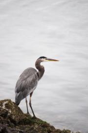
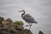
This NWR was established in 1938 to protect one of the last remnants of coastal old-growth forest. Giant Sitka spruce and western hemlock provide habitat for federally threatened bird species, including bald eagles.
Spring is the time to view peregrine falcons and nesting common murres. During winter months, one can observe three species of scoters, western grebes, and common loons.
Highway 101 Lincoln City to Newport
From Lincoln City, Highway 101 crosses the Siletz Bay National Wildlife Reserve and continues through Gleneden Beach to Depoe Bay. South of Depoe Bay, Highway 101 rises rapidly over Cape Foulweather. The earlier highway is only open to light traffic and winds its way around the cape considerably farther down. On the south side of Cape Foulweather is the small community of Otter Rock, with a "downtown" consisting of about a block of small businesses next to the Devil's Punchbowl. Between Otter Rock and Yaquina Head, the roadbed shows the instability of the local geology. In some places, the highway has simply been rerouted around places where it had proved impossible to prevent the continued subsidence of the grade.
Otter Crest State Scenic Viewpoint
Perched 500 feet high atop Cape Foulweather, Otter Crest State Scenic Viewpoint gives you a spectacular view of the Pacific. To the south is a broad expanse of sandy beach, while in front of you the waves crash against the rocky headland. Next to the parking lot is the Lookout Gift Shop. The old highway ran right past the viewpoint. The current highway passes higher up, so you'll exit and take travel a few yards downhill to reach the viewpoint.
Located south of Cape Foulweather along a later-circumvented stretch of the original Highway 101, the Rocky Creek Bridge was designed by famous engineer Conde B. McCullough and was completed in 1927.
Crossing a section of Otter Crest, it is also known as the Ben Jones Bridge for the man credited for being "the Father of the Coast Highway." Jones introduced legislation to fund what was originally named the Roosevelt Military Highway in 1919 and convinced Congress to pay half the cost of constructing the Oregon Coast Highway.
North of Yaquina Head, Highway 101 enters the city of Newport, junctioning with Highway 20 in the middle of town.
Highway 101 Newport to Yachats
Across the Yaquina Bay Bridge, Highway one offers some glimpses of the ocean but usually just runs a bit inland until Waldport, where it crosses Alsea Bay. It continues to wind along the coast until it reaches the small community of Yachats. A number of state parks along the way are good for picnicking, and a few offer campsites as well.
Milepost 141.0 Newport (ZIP 97365)
141.0 Junction Hwy 20 Hwy 20 runs east through the Coast Range and on to Boston, Massachusetts. At 3,365 miles, it is the longest road in America. Seven miles inland it passes Toledo at the head of Yaquina Bay
142.0 Yaquina Bay Bridge and Lighthouse Yaquina Bay Lighthouse is part of the state park at the north end of the graceful, historic coast bridge. The lighthouse and its small tower on top have been turned into a museum. Yaquina Bay bridge’s dramatic, high-soaring steel arch make this one of the most photographed of McCullough’s bridges. It is high enough for boats to pass under and has a combination of both steel and concrete arches. At each end of the bridge is a pedestrian plaza with stairways leading to observation areas. From the north end of the bridge, a fairly steep street leads down to Bay Boulevard and Newport’s Bayfront. Newport’s working waterfront rubs shoulders with restaurants, shops, and tourists attractions. Farther on, Bay Boulevard becomes North Bay Road, following the route of the 1885 Oregon Pacific Railroad along the Yaquina River to Toledo. The 13-mile scenic drive features river and estuary vistas, historical markers, and bike and walking lanes.
Highway 101 Yachats to Florence
178.3 Heceta Head Lighthouse Devils Elbow beach located here is somewhat protected and has restroom and picnic tables. From the beach follow a trail to the former assistant lighthouse keeper’s home, Heceta House, and continue to lighthouse. Fee area. Heceta House and the lighthouse are open for tours Memorial Day through Labor Day, hours vary. Heceta House is also a B&B, 547-3696.
179.0 Heceta Lighthouse Viewpoint If you’ve seen a calendar with a photo of Heceta Lighthouse, the chances are good that this is where the picture was taken. Limited parking.
178.4 Cape Creek Bridge The bridge abuts the Cape Creek Tunnel and is best viewed from Devil’s Elbow Beach at Heceta Head Lighthouse. It’s one of McCullough’s most unique and attractive arch designs. With its numerous columns and arches, it is reminiscent of the Roman aqueducts, particularly the Pont du Gard near Nimes, France.
190.0 Hwy 126 Junction Fourteen miles inland is Mapleton (ZIP 97453). Many businesses in this unincorporated community depend on the Siuslaw River, which flows through the middle of town. Boating and fishing are the most popular activities. Because Mapleton is inland and farther from the ocean, warmer temperatures and less wind prevail in the summer.